This page was last updated on: January 19, 2016
THE LEVERSTOCK GREEN CHRONICLE
an in-depth history of one village in Hertfordshire UK.
Click to link to principle LG Chronicle web pages.

BEFORE AND AFTER THE EXPLOSION OF
11 DECEMBER 2005
The Bunne Family & Bunne's Field. (13th-17th centuries) 18th century to Pre- Newtown Buncefield Farm The Oil Depot Incidents at the depot before 2005
11 December 2005 Photogallery Day 1 Tell me YOUR story SUNDAY 11TH DECEMBER 2005 ~ A FIRST HAND ACCOUNT by Barbara Chapman
Photogallery Two - the month following the disaster The Biggest Peacetime Blaze in Europe
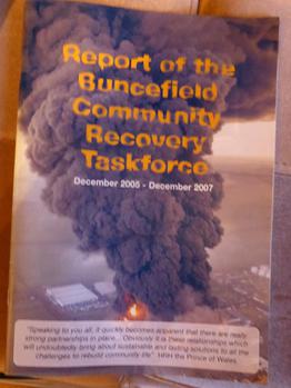
Community Recovery Taskforce LGVA Newsletter items relating to the effects of Buncefield etc. One Year On 2015 - Ten Years On More Picture Galleries
Newspaper items (National/Local and if possible International) re Buncefield
PLEASE READ: To save repetition of what I have already posted concerning Buncefield, some of the links in the navigation area will take you to a point in the original website.(Which, accidentally I created within the bacchronicle website at Homestead, and it is impossible to copy over details from a bacchronicle page to a lghistorian page, as when I first started building my site, there was a limit to how much space could be used per site.) Once I have finished this new site, I will delete the current title box and just leave the one I am creating for this site - though the actual site will still be there, with direct links from this page.
Barbara 6 Dec 2015


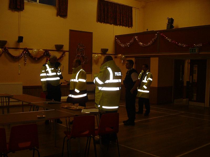
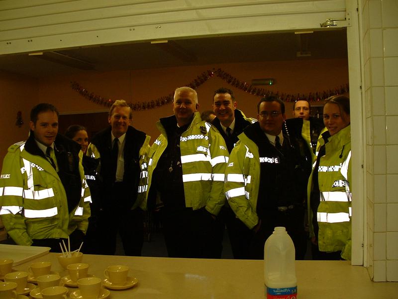
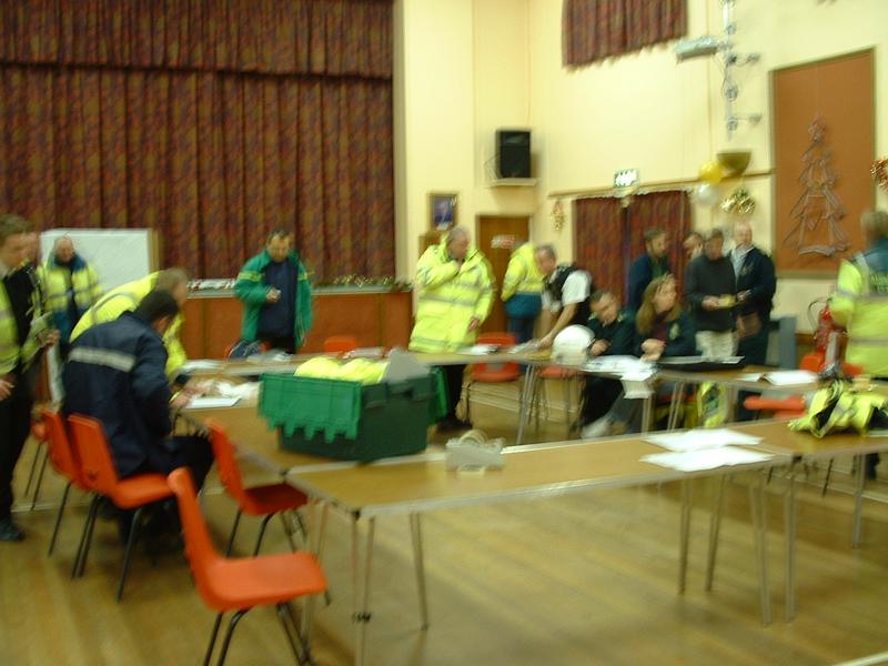
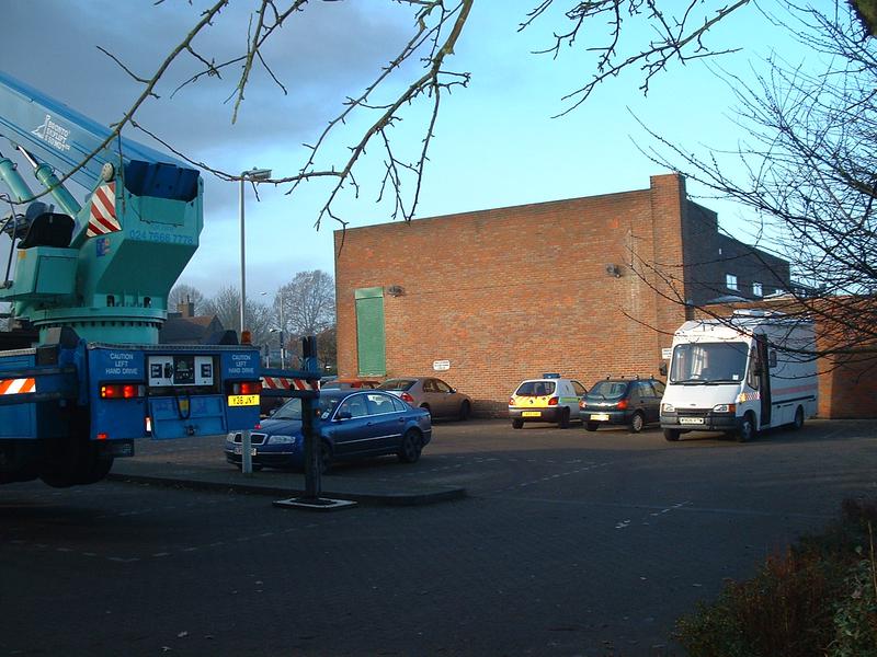
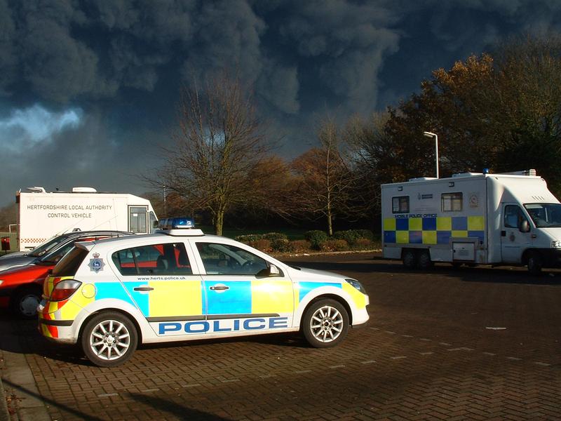
Taken throughout the day inside, or just outside the back of the Village Hall which was a Bronze Command Station for the Police, and where reinforcements came from all over the country to help. Margaret & Ralph Rayner, myself and husband Martin kept the Police, occasional Firemen and other emergency staff plied with tea, coffee, biscuits and later sandwiches.
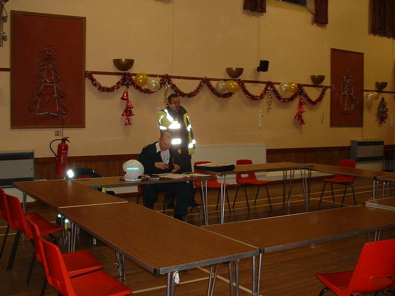
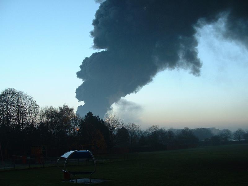
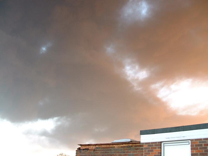

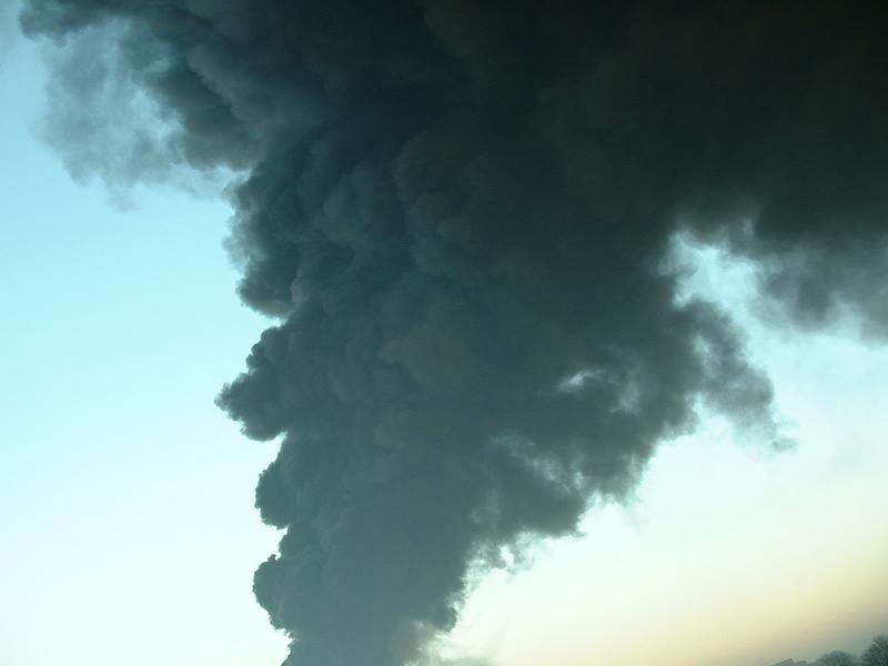
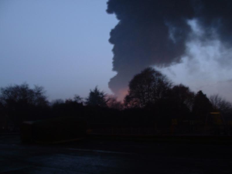
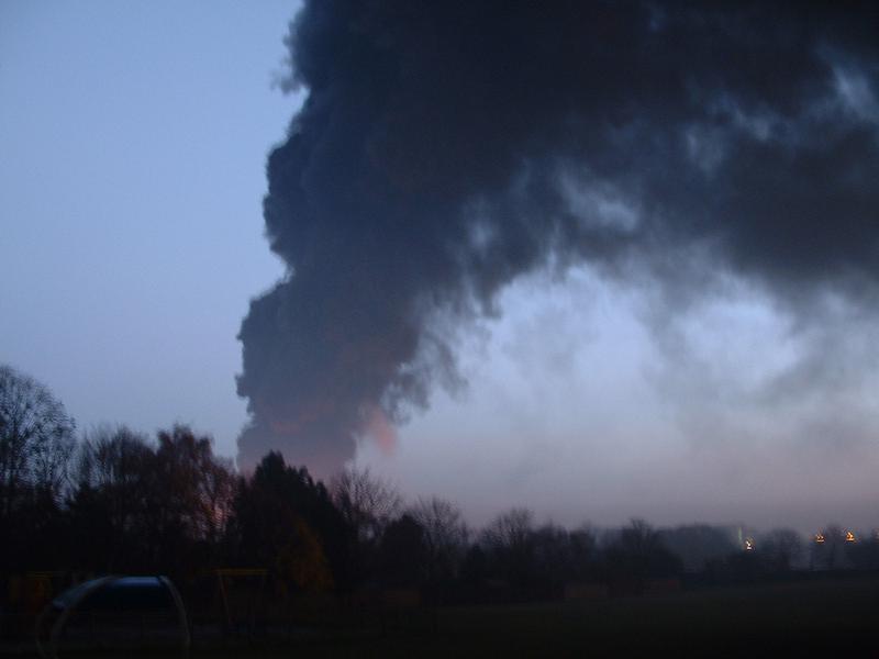
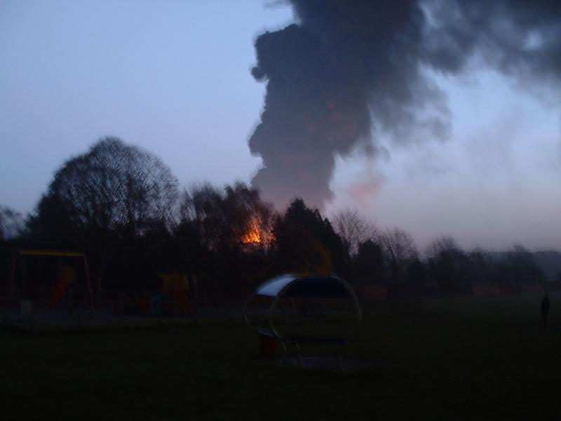
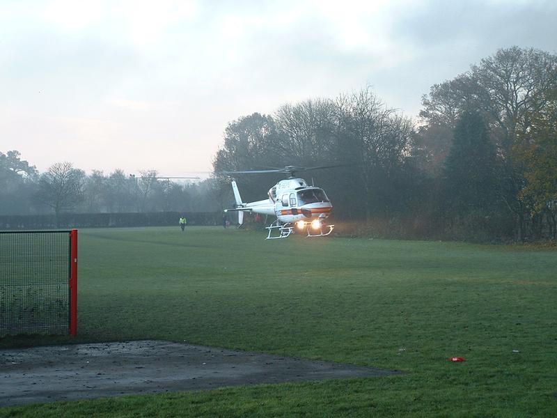
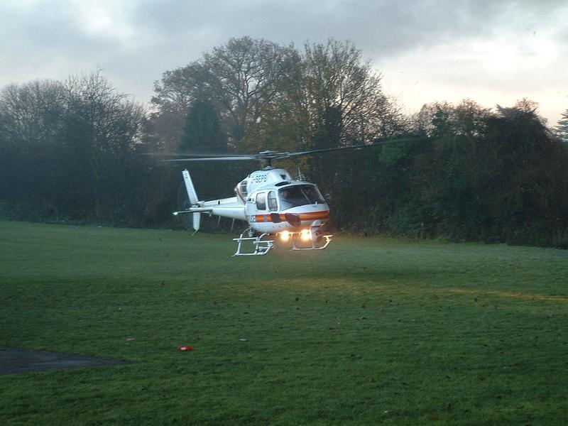
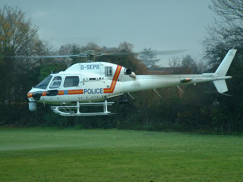
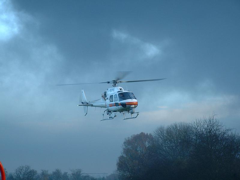
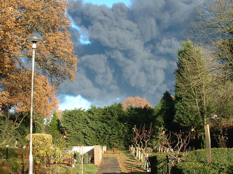
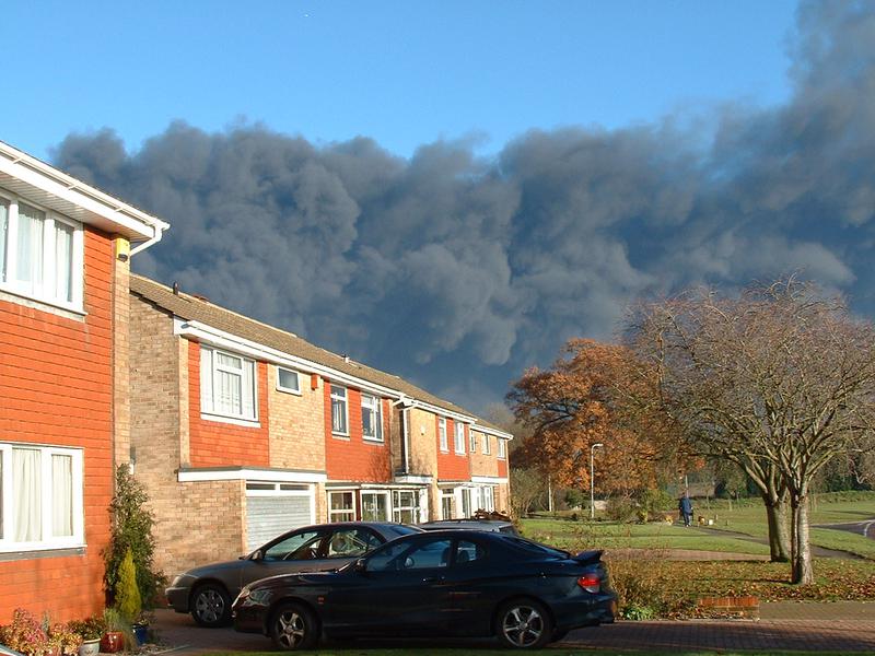
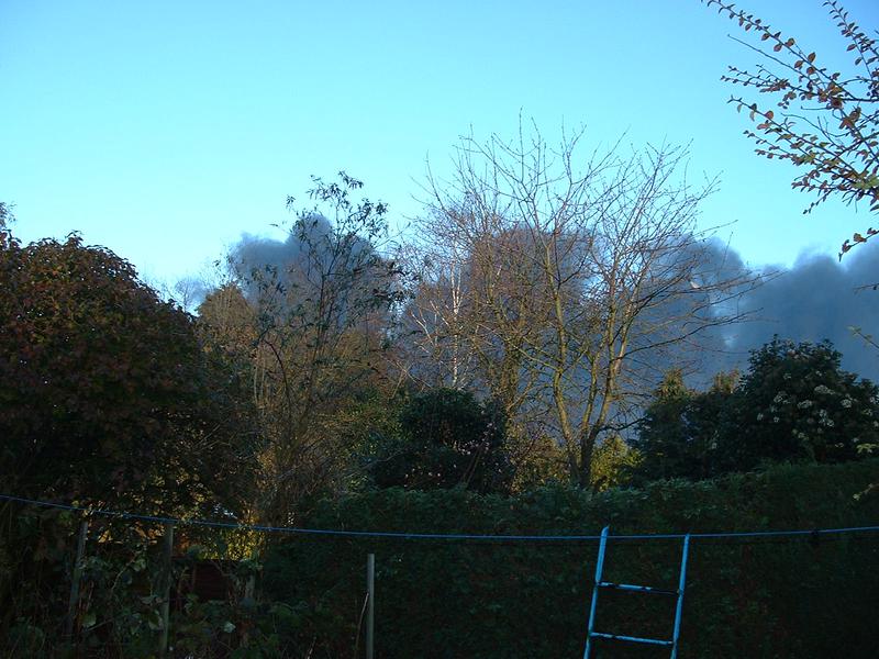
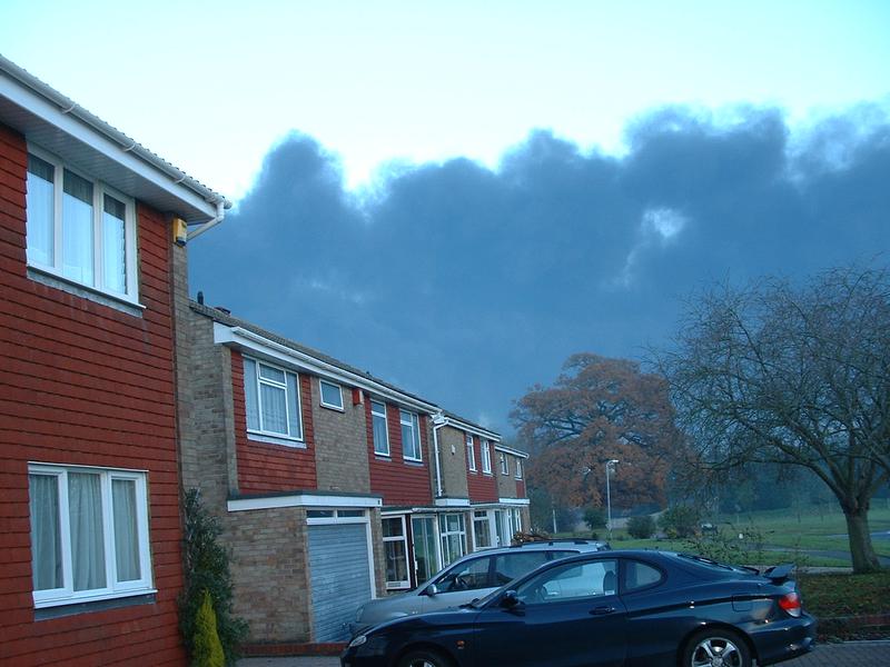
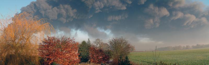
As the day progressed the pall of smoke hanging over the village got denser. Some Police staff came in by helicopter.
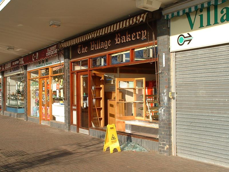
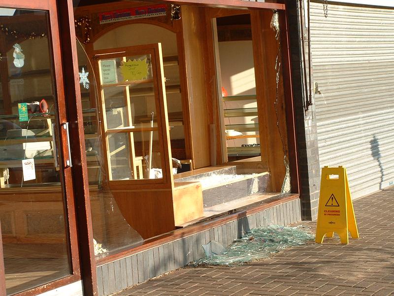
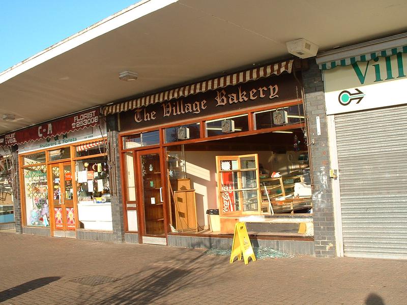
I took a brief wander outside mid-morning, and later about 1:30pm to see what was going on outside. TV crew were present and preparing a platform lift for filming, and the effects of the blast on shop fronts in the Village Centre, Leverstock Green was obvious.
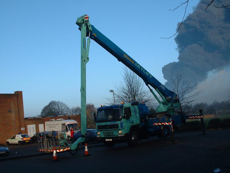


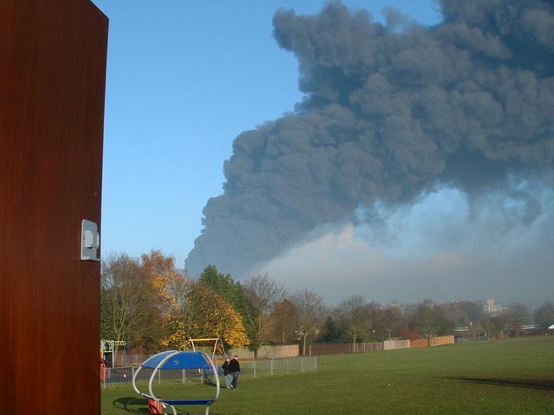
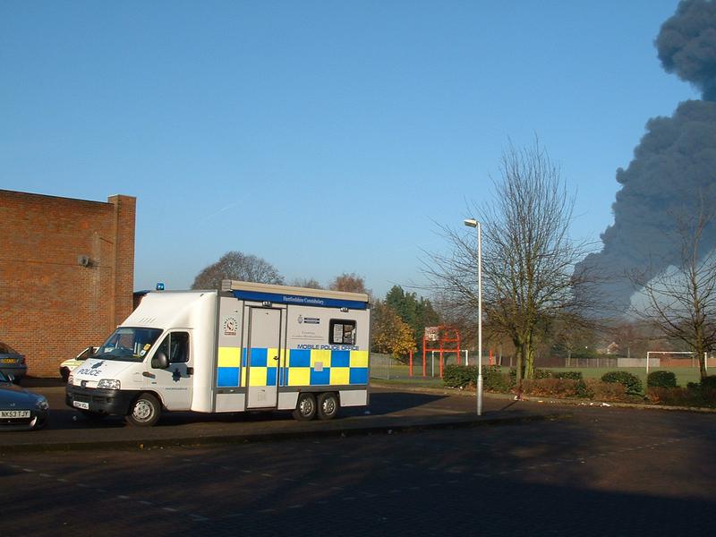


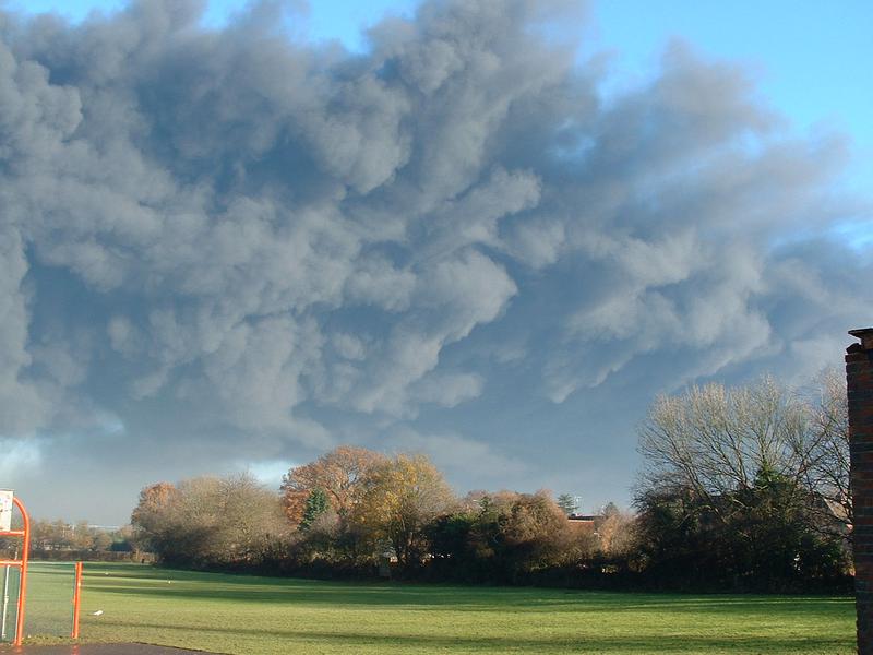
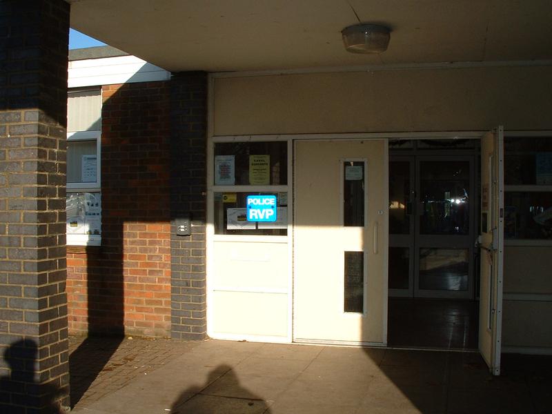
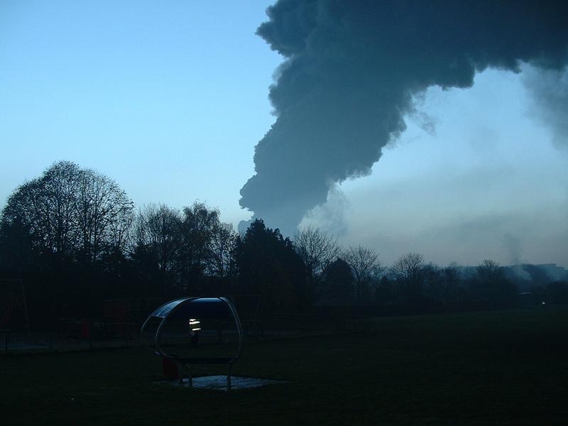
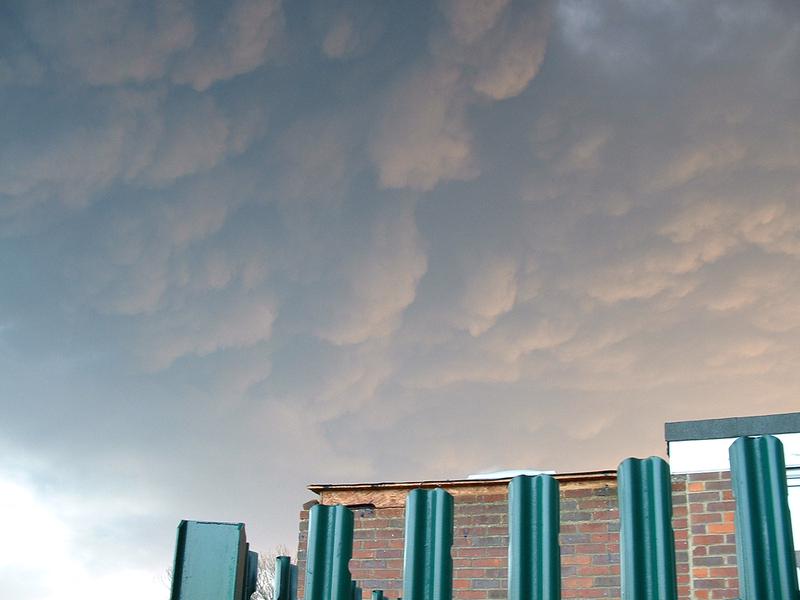
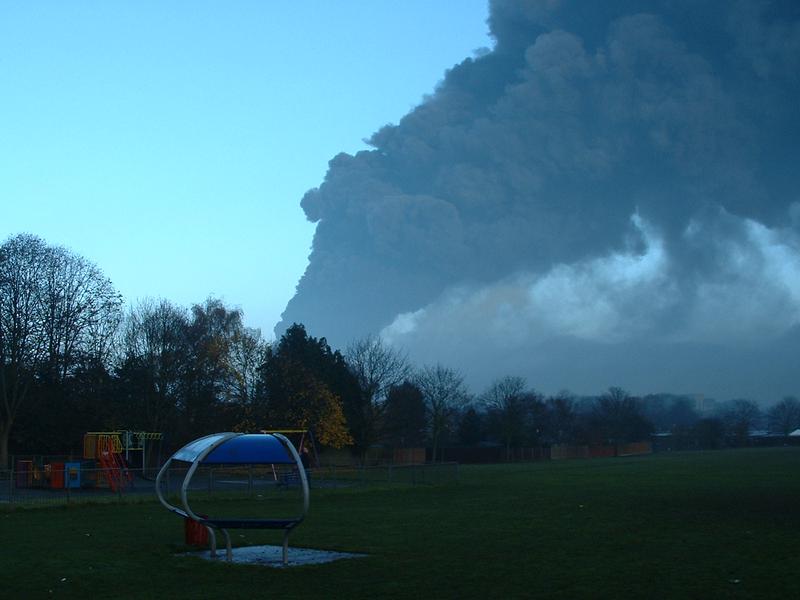
Later in the afternoon I took another wander. A notice on the hall door announced that it was now a PRP - A POLICE RENDEVOUS POINT. The black cloud seemed to be getting denser, and a slight shift in the wind direction meant that the cloud was now virtualy directly overhead! The BBC Camera crew's "chery picker" was now in position.
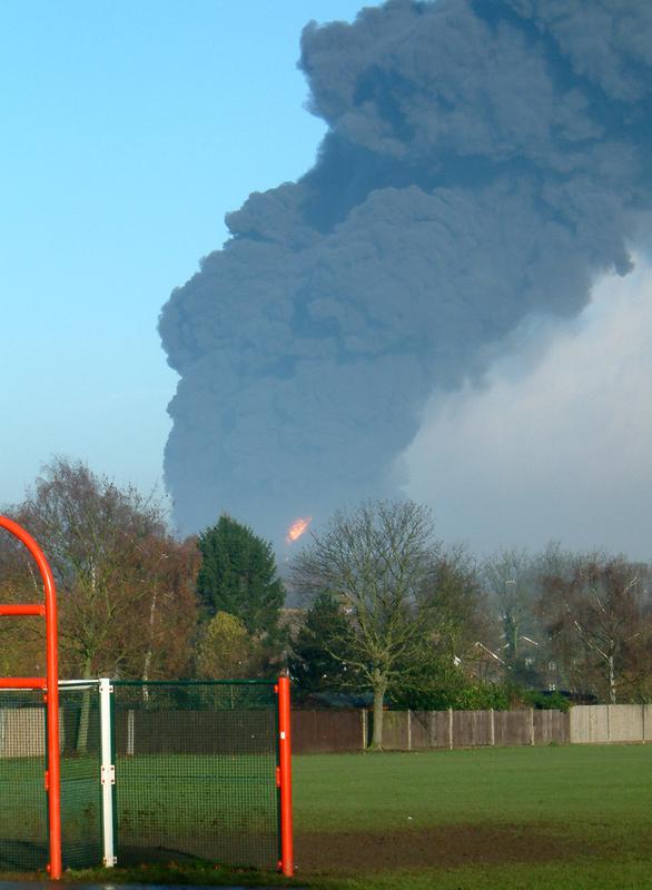
Many individuals, myself included took lots of photos relating to the Buncefield fire, both on the day of the explosion, and later on as the extent of damage etc. became more obvious, or in the case of the industrial estate, roads opened so that one could see the damage for the first time. Below I shall post photographs taken by named individuals in the first few weeks which I hope will given an idea of what we all had to come to terms with. My thanks go to these individuals who have let me use their photos, and to remind you that copyright remains with the individual photographer.
Click on names to see photos by individual photographers.
11 DECEMBER 2015 - THE DAY OF THE EXPLOSION -
(Written shortly afterwards)
"As the local community continues to count the cost both financially and emotionaly of the what has been billed as the largest peacetime fire in Europe since WW2, as the local historian I have been anxious to record the event and create an archive for future generations. In addition to all the gathering and recording that involves, and immediatly of more importance, in my role as Chairman of the Leverstock Green Village Association I am a member of the Community Task Force which has been set up by DBC to try and address some of the problems resulting from the fire. This naturally is taking up much of my time, and together with all my normal activities means I am not likely to have the time for a while to post the rest of the relevant information on this website. However, it is my intention to post more than just this first day's account eventually. So, WATCH THIS SPACE!
THE BUNCEFIIELD COMMUNITY RECOVERY TASKFORCE:
On a personal note, it had been my original intention to write a day by day account of how things unfolded. Events rather overtook me and I never did, largely because I was invited to join DBC's Recovery Group Panel representing LGVA.
The REcovery Groups role was to
provide and co-ordinate ongoing support to the affected residents and wider affected community
ensure the provision of information to all concernedfacilitate assessment of the long term impact on the community cohesion and capacity
report progress back to the Recovery Group on a regular basis.
As part of this work the LGVA newsletter distributors delivered a communication to all households in the village on behalf of the Task Force, in addition to their normal tasks.
The health of the Maylands business community has a direct effect on many of our local residents and businesses and is paramount to the well being of our Village. A multi agency forum took place in the Village Hall in March to address some of the issues raised.
I represented the Association at a meeting with Deputy Prime Minister John Prescott and was able to put pertinent questions to him, and I continue to work with the Community Recovery Group within Dacorum Borough Council’s Task Force.
LGVA also hosted a meeting of those on the Health and Safety Executive conducting the investigation, to enable a sharing of information, and allow local residents to voice their major concerns.
LGVA continued to support Dacorum Borough Council in any way that it could for the benefit of our residents, and in particular by ensuring all residents were aware of where they could seek either financial help or advice on any issues resulting from the explosion. Many of the problems with regard to unemployment and initially undetected damage were only just surfacing by the summer, and it was anticipated that we shall need to continue in this supportive role for some time to come.
The Community Recovery Group’s focus then moved on – focusing on the positive rather than the negative. We worked with local schools and school children on a number of initiatives both to ensure our young people really understood what happened and had an outlet for their own concerns, and to see how we could move forward from the event. The Youth Forums initiated by the group were nominated for a prestigious award. A People’s Exhibition tookplace during the weekend of 9-11 December 2006, staged in a Big Red Bus in Marlowes on the Saturday; around the area on Sunday & in the village for the tree ceremony etc. on the Monday., and later on the Industrial Estate. The Pin Oak, planted on the Village Green at Leverstock Green in commemoration is still thriving.


Photos by Barbara Chapman Day 1
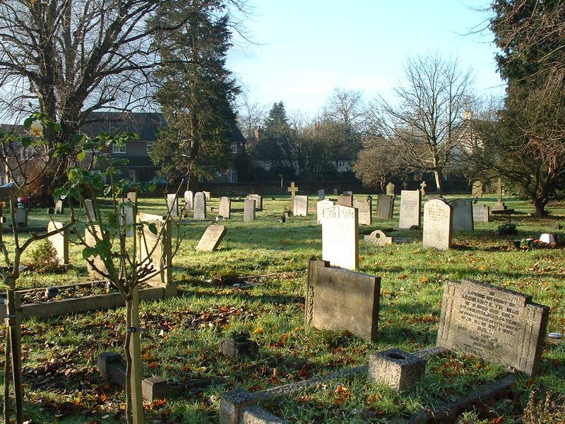
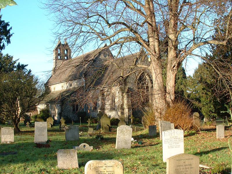
The Police having scaled down the opperation in the village hall by 1:30, and having been told by the vicar of damage to the East Window at Holy Trinity, I went home via the churchyard to see what it was like.(See large crack and movement in the picture below) Once home it was obvious the wind had swung round abit and the cloud was heading westward.

Photographs by Nick Taylor Day 1
Day 1- 11 December 2005
Nick, as well as being a local resident and member of the LGVA committee, also worked for the BBC at the time as a video news editor. He was therefore allowed up on the "cherry picker" with the camera man who was filming from outside the village hall.


")


Photographs by John Baldwin Day 1


 mid morning.")
 Mid morning.")


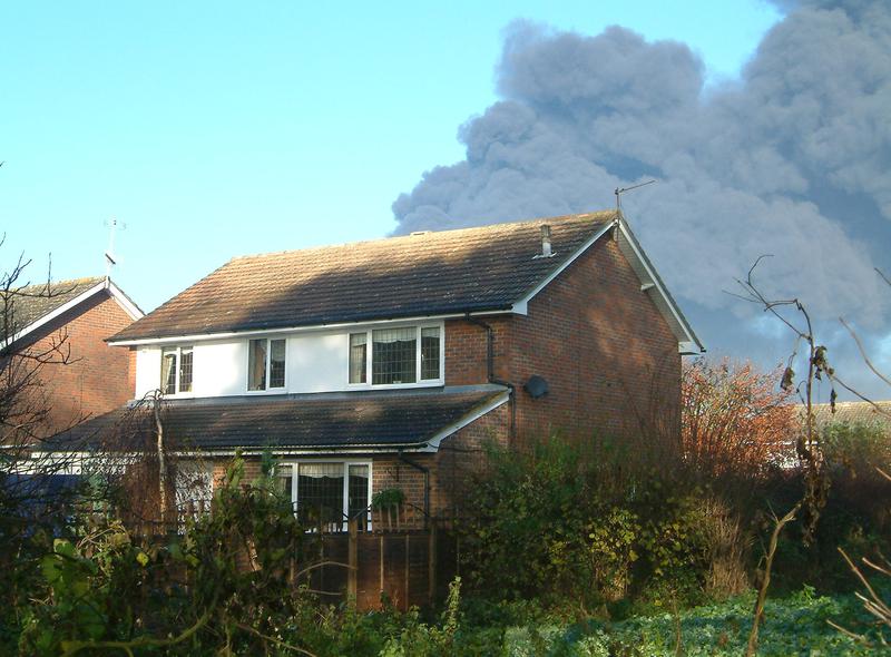
John is an LG resident and member of the LGVA Committee. Photos taken in Bedmond road were facing NE
19TH CENTURY& PRE NEW-TOWN BUNCEFIELD FARM


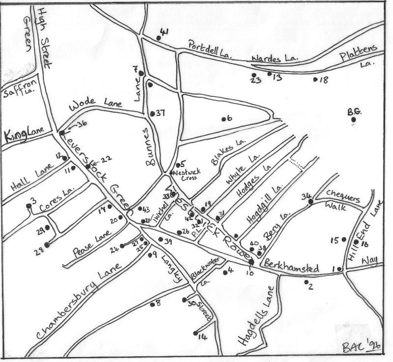
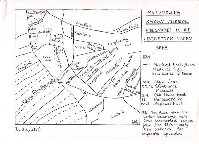
MAP SHOWING PRINCIPLE ROUTEWAYS AND DWELLINGS AROUND "LEVERSTOCK GREEN" FROM THE MIDDLE AGES TO THE 17TH CENTURIES.
Click on underlined blue entries to link to a relevant page.
Of the many recorded medieval field names in the area dating from 1272-1274, a couple refer to fields connected to the Bunne family: Buns or Bunnes Crofte, Bunslande, [Reconstruction and Measurement of Landscape Change: A Study of six parishes in the St. Albans Area. British Archaeological Reports: British Series 236, 1994. by Jonathan Hunn. Published by Tempvs Reparatvm, Oxford 1994, HALS document XI2 - Being a detailed survey in English, undertaken in 1569 for Sir Nicholas Bacon, of all the manors and lands which he owned or of which he was Lord. This including the manor of Gorhambury, Westwick and Pray.] (i.e. Bunne’s Croft (farm) and Bunne’s Land.)
In the fourteenth century, the Bunne family was known to be associated with various properties around Westwick Row(e) [HALS ref XI2]
In 1384 the earliest mention I have come across so far of manorial lands belonging to the priory of Markyate in Leverstock Green., that is as it was then known the MANOR OF LEVERSTOCK ALIAS MARKATE (or Market) OAK OR MARKET DOLE. (give URL to my site on Westwick Manor) In this instance John ate Raggs and his wife granted all their lands in Westwick late of the Prioress of Markyate to John Bunne and his wife. [HALS ref 1 N 1] ( See entry for 1541/2 ).
Approximately a century later on 27th December 1479 - The will of Richard Turnour from the parish of St. Michael (St. Albans) was made. Although I have no evidence as yet to suggest he may have lived within our area, several of the bequests were made to members of the Bunne family and to the children of John Merston ( or Marston.) Earlier in 1479 John Merston had possession of Bromley Croft, which was just on the eastern border of our area, and later in 1549 his grandson John acquired Hill End. The will read as follows:
"My body to be buried in St. Michael's churchyard. To the high altar of the same church 12d and to each light 2d. To my father 6s 8d. To John and Cecily, children of John Merston, each 20d. To Helen Rassh for mending a tunic 3s 4d. The residue to Thomas Bunne whom I appoint as my executor and I bequeath 20d to him for his labour in levying and collecting my debts as follows: 24s from Giles Bunne for money borrowed from me, from Henry Harrys for threshing 14 quarters of grain not paid for (amount not given). Witnessed by Sir John Garnet, vicar of St. Michaels, Thomas Welles, parish clerk, Giles Bunne and many others.” [St. Albans Wills 1471-1500. Published by the Herts. Record Society. Vol IX 1993; and HALS ref IE6]
- In the will of George Armstong on 3rd January 1479/80 an official and practising civil lawyer, he bequeaths to Giles Bunne his `bestbyll' and to Thomas Bunne his second `byll'. Thomas and Giles were the sons of Agnes Bunne of Westwick who died in January 1472/3. George Armstrong had been one of the witnesses to her will. [St. Albans Wills 1471-1500. Published by the Herts. Record Society. Vol IX 1993 page 262]
On 20th May 1569 a Survey was undertaken of the Manor of Gorhambury, Westwick and Prey for Sir Nicholas Bacon, by Hughe Mantell and Richard Bowsewell. It is the earliest written survey in English of the manor, and actually covered all the manors of which Nicholas Bacon was then Lord. The survey, which is written in an incredibly clear hand, is bound into one large volume (see photos) and details minutely all the holdings within the manor, and whether they are part of the demensed estate or belonging to someone else either by freehold or copy hold. Within each manor the entries were listed according to the lands held by individuals, rather than geographically. Each entry stated the name of the piece of land etc. and which other plots bounded it to the north, south, east and west. This therefore gives us some extremely valuable information not only about who owned and farmed the various parcels of land, but also the relative positions of all the fields and holdings, as well as the individual field names. are, however, some problems concerning the survey which Jonathan Hunn pointed out in his report. [Reconstruction and Measurement of Landscape Change: A Study of six parishes in the St. Albans Area. British Archaeological Reports: British Series 236, 1994. by Jonathan Hunn. Published by Tempvs Reparatvm, Oxford 1994 p.101]
...... Richarde Smythe was another copyholder of property in and immediately around Westwick Row. This was in addition to the land he rented from William West. It included another property in Westwick Row itself including Bunescrofte and Beryfeild.
In the section on Beryfeild it said:
" One other close of lande called Beryfeild withe a way leading thense to the said tenement abbutting east upon a field late Bunne and afterwards the said Smithes and nowe the Lordes by exchange with the same Smith."
Another family, the Peacocks were referred to in the survey having amongst other holdings, Berryfeilde and Peazecrofte, and separate from the rest of his holdings being:
" eastwards uppon a Lane called Bunnes Lane and Westwarde uppon another lane leading from Woodend to St. Albans and northwards upon a close called middell Berry Feilde and Southwarde on a close of lande late Sares called Mynettes."
KEY TO PRINCIPAL DWELLINGS IN THE LEVERSTOCK GREEN AREA
11TH-17TH CENTURIES
Map Key Name of DwellingAlternative Name(s)
1Beechtree
2Beechtree Cottages
3Bennetts EndBeneyet's: Bennetts End House/Farm (spelling varies)
4BlackwaterBlackwater Pond House/Farm; BlackQueen
5Laurence FarmBottom House
6Breakspears
7BuncefieldThis generally referred to a group of small dwellings rather than an individual one.
8Bunkers FarmBunchers
9ChambersburyRectory Manor
10Westwick CornerCorner Farm; The Corner
11Cox PondGreat Cox Pond
12CrabtreeCrabtree Pesthouse; The Crabtree Inn
13Hangman's CroftGossoms; Whytes Farm
14Highwood HallHighwood Hall Farm
15Stones HallStonehall;Hillend Cottage
16Hill EndHill End Farm
17Hill Farm
18KettlewellsWards(various spellings)
19King Charles II Cottage
20Carpenters FarmLeverstock Green Farm
21The Leather Bottle
22Little Cox PondLittle Cox Pond Farm
23Megdells(Various spellings)
24NorthendNorthend Farm
25Northend Cottages
26The Red Lion(Now St. Michael's End)
27The Rose & Crown(Now The Elms)
28Tyle KilneTile Kiln House/Farm
29The Old Cottage(Current name)
30Well Farm
31Westwick Westwick (Row) Farm, Westwick Manor
32Westwick Cottage(Current name)
33Westwick Farm(Current name - at one time was known as Westwick Row Farm, & 31 above as just Westwick Farm!)
34Westwick HallWallers; Bottom House
BGGorhambury(Sir Nicholas Bacon's House)
36Woodlane EndWoodlane End House/Farm
37Woodwells(Various spellings)
38Meads
39Market Oak Manor(Position approximate)
40(The Old House)(As referred to in various documents, not a proper name.)
41PalmersThree Cherry Trees Farm(1766); Lower Cherry Trees Farm(1950's)
42Dell Cottage(Present name); Kiffs Fm.
43StonardStonerds
THE BUNNE FAMILY & BUNNE'S FIELD. (13th-17th CENTURIES)
From the thirteenth to the 17th centuries, a family known as Bun (spelt in a number of ways in old documents e.g.Bunn Bunne or Bunnes) lived in the Manor of Westwick. They owned land and at least one dwelling of some kind, (Referred to as a croft). Their name was given to the ancient Iron Age trackway which led to their land, and as time progresse the area itself was known as Bunnesland, or BunnesField. By the late 19th century the small farm or hamlet on the site was known as Bunsfield/Buncefield and/or Buncefield Farm, and the land around it known as Buncefield.
Thirteenth Century records of the parish of Hemel Hempstead show names in the area of WESTWICK CROSS, THE TYLEKILL and LASTOCKINGE. [ Victoria County History Vol 2 p.216] According to a map showing the holdings of Margaret Wootton,[ S1 p.30 ], Westwick Cross is where Westwick Row meets Green Lane ( There is a staggered cross-roads still there, joining Green Lane, Buncefield Lane and Westwick Row.)
The first documented settlement at Buncefield so far discovered, was recorded in 1270. The field itself being recorded the previous year as belonging to Peter Bunne. [History of Hemel Hempstead - Hemel Local History Society. p.9 & HALS document XI2 - Being a detailed survey in English, undertaken in 1569 for Sir Nicholas Bacon, of all the manors and lands which he owned or of which he was Lord. This including the manor of Gorhambury, Westwick and Pray. ] The Bunne family over the next five centuries were important landowners and farmers throughout the area, albeit on a minor scale, and once branch of the family over several generations were Blacksmiths based at Piccotts End. [History of Hemel Hempstead - Hemel Local History Society. P 85-86]
18th CENTURY TO PRE-NEWTOWN BUNSFIELD (BUNCEFIELD)
[The spelling of Buncefield varied considerably over time and in differing documents.]